

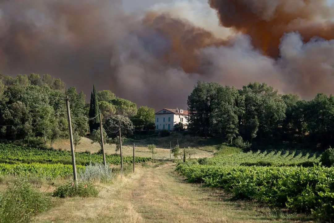
A major spell of rain and thunderstorms across the Var and Alpes-Maritimes is bringing much-needed relief from the extreme conditions that have fuelled wildfires this summer, with further storms possible into Friday. But after weeks of exceptional heat and drought, experts warn that it will take considerably more rain to remove the underlying fire danger.
The change in weather has been dramatic. After weeks dominated by heat, parched vegetation and heightened wildfire alerts, repeated waves of thunderstorms have swept across south-eastern France, delivering substantial rainfall across the Var and Alpes-Maritimes.
The most intense phase began around midday on Thursday, when very heavy thundery showers developed particularly over inland areas and higher ground. More than 3,000 lightning strikes were reported in the Alpes-Maritimes and 2,500 in the Var by early afternoon, while torrential rain fell across large parts of the region.
Météo-France warned that the strongest storms from Provence to the Côte d’Azur could produce 40 to 60mm of rain in just one hour, and locally even more, along with hail and strong wind gusts.
The unsettled spell extends into Friday. Météo-France said several waves of thunderstorms would move through the south-east through Thursday night and Friday morning, with storms possible from the Provençal coast and Côte d’Azur towards the Alps. Some could again be locally strong and very wet, particularly around the Côte d’Azur, before conditions progressively improve.
Much-needed rain after weeks of extreme conditions
For the Var and other fire-prone areas of Provence, the rainfall could not have come at a more important time.
Weeks of extreme heat and exceptionally dry conditions have left forests and vegetation highly vulnerable to fire. Météo-France reported earlier this week that soils across France had reached their driest levels since records began, while forest-fire danger has remained significant around the Mediterranean.
The lack of rain has been particularly pronounced in the south-east. July brought virtually no relief to parts of the Riviera, leaving vegetation increasingly dry as successive periods of extreme heat pushed temperatures higher.
The amount of water delivered by this week’s storms can rapidly change conditions at the surface. Grasses, leaves, pine needles and other fine vegetation that ignite easily become wet, while falling temperatures and much higher humidity make it considerably more difficult for fires to start and spread.
For firefighters who have spent much of the summer facing exceptionally challenging conditions, the rain therefore represents a significant reprieve.
Will the rain end the wildfire danger?
Not yet. While the difference on the ground may be immediate, one spell of heavy rain cannot reverse the effects of a prolonged drought.
Surface vegetation can absorb moisture relatively quickly, but deeper soils, forest litter, trees and larger vegetation require sustained rainfall to recover from months of moisture loss. Mediterranean vegetation can also dry out remarkably quickly if temperatures rise again, humidity falls and strong winds return.
The determining factor will therefore be what happens after this storm system passes. Several substantial rainfall events through the remainder of August and into September would progressively restore moisture to vegetation and soils and could bring a more lasting reduction in wildfire danger. If this week’s storms are instead followed by another prolonged spell of heat, low humidity and strong winds, conditions could deteriorate again rapidly.
Lightning presents another complication. Thousands of strikes were recorded across the Var and Alpes-Maritimes during Thursday’s storms, and lightning can ignite vegetation where strikes occur away from the heaviest rainfall or where fuels remain dry.
Heavy rain brings a different set of risks
The same rain helping to suppress the immediate wildfire danger is also creating new hazards. With Météo-France warning of rainfall totals reaching 40 to 60mm in an hour and potentially more in some locations, intense storms can overwhelm drainage systems and cause rapid runoff, local flooding and hazardous driving conditions.
Recently burned areas are particularly vulnerable. When wildfire destroys vegetation, hillsides lose some of their ability to hold soil and absorb water. Heavy rain can then run rapidly across the surface, carrying soil, ash and debris downhill and increasing the risk of erosion and mudslides.
Residents are being urged to continue following Météo-France vigilance alerts while the unsettled weather persists.
Fire season is far from over
Despite the welcome rain, southern France remains firmly within its summer wildfire season. Around nine out of 10 forest and vegetation fires in France are caused by human activity, meaning the risk does not disappear simply because vegetation is temporarily wetter. Authorities continue to urge extreme caution around forests and other natural areas throughout the summer.
The longer-term picture is also increasingly challenging. The French government has warned that climate change is contributing to more severe droughts, more frequent fire outbreaks and an expansion of wildfire risk into parts of the country that historically faced a much lower threat.
For the Mediterranean coast, however, this week’s change in weather is significant. After weeks of relentless heat, exceptionally dry soils and intense wildfire pressure, the soaking rain across the Var and Alpes-Maritimes is providing the region’s forests — and its firefighters — with a badly needed reprieve.
Stay updated with Monaco Life: sign up for our free newsletter, listen to our podcasts on Spotify, and follow us across Facebook, Instagram, LinkedIn, and Tik Tok.
Photo source: Prefect du Var